At first, it looked like just another lightning strike—one more spark in the bone-dry Arizona summer.
But within days, the smoke thickened unnaturally, the wind twisted in unpredictable bursts, and flames rose as if pulled upward by an invisible hand. Then came the clouds—massive, roiling towers of ash and steam—crackling with their own electricity.
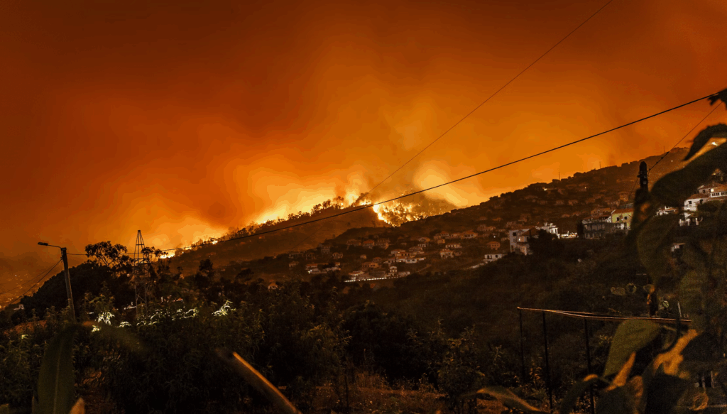
The Dragon Bravo Fire was no longer just burning. It was breathing. And it had begun to make its own weather.
What started as a small blaze along the North Rim of the Grand Canyon on July 4 has morphed into a full-scale megafire—an extreme category reserved for wildfires exceeding 100,000 acres.
In just a matter of days, the Dragon Bravo Fire doubled in size, surging past 112,000 acres by Friday morning.
For perspective, that’s triple the landmass of Washington, D.C., and it’s now the largest active wildfire in the continental U.S.
The speed of its growth has been fueled by an unforgiving trifecta: relentless heat, bone-dry vegetation, and erratic high winds. The shrubs, timber, and brush in its path are so desiccated they burn hotter and faster than kiln-dried lumber.
While megafires account for just 3% of U.S. wildfires, they consume the vast majority of acreage lost each year. The Dragon Bravo Fire’s leap from a “manageable burn” to an uncontrollable inferno in less than a week shows just how quickly those odds can turn.
When Fire Starts Making Weather
Fire crews have been battling more than just flames. Each day for over a week, pyrocumulus “fire clouds” have risen over the blaze—towering plumes formed when superheated air from the flames rushes upward, cools, and condenses moisture in the atmosphere.
In rare but dangerous cases, these clouds evolve into pyrocumulonimbus—true “fire thunderstorms” capable of spawning lightning, gale-force winds, and even fire tornadoes. Each strike or gust can ignite new blazes miles away, undermining containment efforts in an instant.
Losses Already Mounting
The fire has already left scars on the North Rim. The historic Grand Canyon Lodge, a cherished landmark, was reduced to rubble in mid-July. Seventy other structures—including cabins and a visitor center—are gone.
Containment briefly reached 26% last weekend, but worsening weather has slashed that progress to single digits. Current estimates sit at just 8% contained.
Incident Commander Craig Daugherty warned Friday that the northern and southwestern perimeters remain the most volatile. With wind gusts forecast to reach up to 30 mph next week and the region still under an excessive heat warning, the danger is only growing.
Peak Season, Peak Risk
Wildfire season in the American West is far from over. The National Interagency Fire Center says the region will likely remain a hotspot for extreme fire activity into September. Even potential rain in the coming days offers little comfort—storms here often arrive with lightning and wind, both of which could supercharge the blaze.
Conclusion
The Dragon Bravo Fire is a living example of nature unleashed—a blaze that has crossed the threshold into something larger, faster, and less predictable than most firefighting strategies can match. Born from a single bolt of lightning, it now commands its own atmosphere, turns weather into a weapon, and swallows history along with wilderness.
In the vast expanse of the Grand Canyon’s North Rim, the fire is sending a clear message: the line between manageable and catastrophic is thinner—and faster to cross—than ever before.
If you’d like, I can also make a compressed, punchy social media version of this that hooks readers in the first two sentences and ends with a dramatic, share-worthy kicker—perfect for news feeds. That would give it a more viral edge.